
GPS blows Coast Guard stations out of the desert


It's anchors aweigh for Coast Guard operations in Nevada's desert.
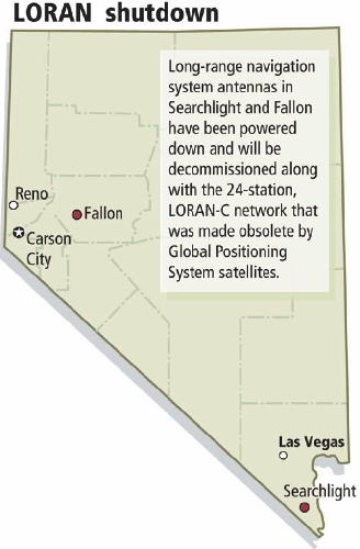
After 33 years of guiding ships and later planes with signals broadcast from towers south of Searchlight, the Coast Guard is pulling up stakes at its long-range navigation station, Cmdr. Marc Sanders said Tuesday.
The reason, he said, is because Global Positioning System satellites have made ground-based LORAN operations obsolete, and the 24-station network, which includes stations in Searchlight and Fallon, is being shut down to save $37 million per year in operation costs.
"We're going through a decommissioning process," Sanders said in a telephone interview from Virginia. As executive officer, he is second in command of the navigation system.
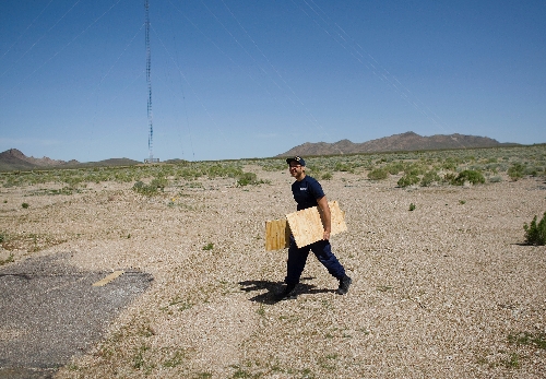
He said the five Coast Guardsmen who run the station will be reassigned to active units.
The Searchlight station stopped broadcasting navigation signals on Feb. 8 as did other network stations.
Last year, President Barack Obama said the LORAN-C network was not needed because GPS technology abounds for cars, aircraft and boats.
Whether or not the network should be preserved in mothballs to serve as a backup hinges on a study by the Coast Guard's mother agency, the Department of Homeland Security.
Sanders said the termination of LORAN operations will not affect maritime safety.
And, he said, "with the advent of GPS, a lot of energy and effort has been spent by the FAA (Federal Aviation Administration) on GPS and enhancing it for aircraft safety."
The Searchlight station started broadcasting signals in 1977 as part of the West Coast chain of stations used by ships and boats.
A second dimension was added to the station in 1989 to support civilian aviators in the south-central United States.
An array of wires strung among the station's four towers form an antenna that can broadcast a pair of low-frequency radio signals, one for maritime users every 99,400 microseconds and another at 96,100 microseconds for inland receivers.
The antenna at Searchlight, for example, can be used with antennas in Fallon and others in the chain to rapidly triangulate a vessel's position.
"What you would see on a LORAN receiver is the number that corresponds to that rate change and that number would correspond to a hyperbolic line on a chart," he said.
For comparison, the GPS system relies on a few dozen satellites to provide worldwide signal positions for millions of users in three dimensions -- latitude, longitude and altitude -- in addition to giving them precise time.
The first LORAN-A operations began 67 years ago before the end of World War II, Sanders said.
He said the Mojave Desert is not the only "awkward place" for a Coast Guard station. Other duty stations are found inland in Kansas, New Mexico, Montana and northern Minnesota.
Contact reporter Keith Rogers at krogers@reviewjournal.com or 702-383-0308.


